Short Description: Mapping of the paratransit transport network in Accra using OSM
Description: In Accra, almost 80 percent of the motorized trip use Trô-trô lines. Those vehicles, 10 to 19-seater minibus, are operated by private operator organized along stops and fixed line. In 2008, the Urban Transport Project was created with the help of the World Bank and the AFD, and, in 2015, Ghana’s government provide Department of Transport (DoTs) in four municipalities of Accra. They’re in charge of taxi and Trô-Trô regulation in Accra and they made a call for project in order to acquire knowledge of the current Trô-Trô service. The wish was to develop an innovative approach by using smartphone technology to simplify the process of data collection and post treatment and, finally, to duplicate this kind of experience in other cities.
Place for experimentation : Accra, Ghana
Map (on development) :Web Site: http://data.afd.fr/accramobility/
Organisations involved in the project: Urban Transport Project, Jungle Bus, Transitec, Ghana's OpenStreetMap community, Agence Française de Développement
Organisation interested to participate / use deliverables: Departement of Transport
Contributors (people): LAINEZ Florian, CHEVRE Antoine, SADDIER Simon, NYAMADOR Enock Seth
Tags: Accra Mobility, Trô-Trô, Paratransit, Jungle Bus, OpenStreetMap, Ghana
Theme: Open Street Map OSM, Données ouvertes, Traces de mobilité et des données associées, Logiciel Libre, Africa
Referent (people):
Challenge associated to your project : Using smartphone and OpenStreetMap local community to create a collaborative and alterable transit map
Common(s) used:OSM Trackers, JOSM, Osmose
Common(s) produced: OSM2GTFS, Jungle Bus – validation ruleset
Linked Communauty of interest: OpenStreetMap
Advisor, mentor useful for the project: LEHUBY Noémie, LAINEZ Florian
Project deliverables: Available & Validated
Digital space for discussion (mailing list):
Chat for direct discussion:
Trello for actions:
Digital space to share files (drive, wiki, etc...): https://git.digitaltransport4africa.org/cities/accra
Needs identified:
Complements:
Next step:
Others informations:
Phases of the project[modifier | modifier le wikicode]
The project was divided in three phases :
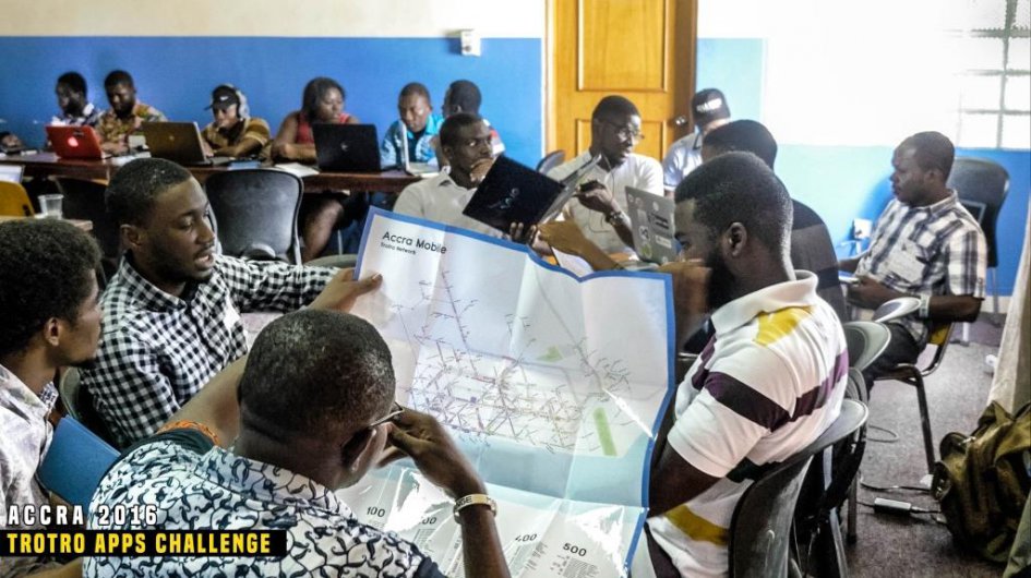
- Phase 1&2 : Students from Concordia University identified the route and the 300 lines that composed the transport network in Accra and, after, they worked on the qualification of the level of service for 60 of this lines.
- Phase 3: The Transitec team, with the help of Jungle Bus association worked on the formalization of a protocol of acquisition and exploitation of the data to automatise the data collection and editing process and to ensure some regular updates.
Data Collection Process[modifier | modifier le wikicode]
After identifying the Trô-trô lines and stops during the phase 1 & 2, the Transitec Team, with the help of Jungle Bus, began to collect and record GPS data (bus stop/routes) directly on OpenStreetMap by using smartphone OSM Trackers app.
Data processing and communication[modifier | modifier le wikicode]
During all the data collection process, the supervisor team worked on checking the data quality while it was collect on the field. They developped a validator Tools on JOSM that allow to check the validity of the data: Jungle Bus – validation ruleset. This program send some alerts about a data set "errors on the tag", "missing transportation mode", "missing ref tag for line number on a public_transport relation"... and allows the supervisor to correct those errors. They also worked with the Osmose validator, a quality assurance tools that detects issues and shows them on OSM.
After that phase of control, they create a GTFS from the GPS Trace that they extract from OSM by using OSM2GTFS.
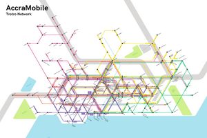
Finally, they created a schematic map of the network by using Illustrator.
Ressources[modifier | modifier le wikicode]
Pilote Project Overview
GTFS Feed
Map (pdf/svg)
Papers
Website
Other languages : ![]() English -
English - ![]() Français
Français


 Français
 English
 Italiano