BIMAGE Datasets
Abstract
Both datasets, from a city centre and a forest represent area-wide street-level reality captures which can be used e.g. for establishing cloud-based frameworks for infrastructure management as well as for smart city and forestry applications. The quality of these data sets has been thoroughly evaluated and demonstrated. For example, georeferencing accuracies in the centimetre range using these datasets in combination with image-based georeferencing have been achieved. Both high-quality multi sensor system street-level datasets are suitable for evaluating and improving methods for multiple tasks related to high-precision 3D reality capture and the creation of digital twins. Potential applications range from localization and georeferencing, dense image matching and 3D reconstruction to combined methods such as simultaneous localization and mapping and structure-from-motion as well as classification and scene interpretation.
The paper is available under: https://doi.org/10.5194/isprs-archives-XLIII-B1-2021-125-2021
Download
The datasets can be downloaded from the following link: https://drive.switch.ch/index.php/s/JHK9tepGKEAUihK
In addition to the two data sets, detailed information about the data structure and data formats is provided as a PDF file.
Please consider that the data is available for academic and research purposes only.
Dataset Description
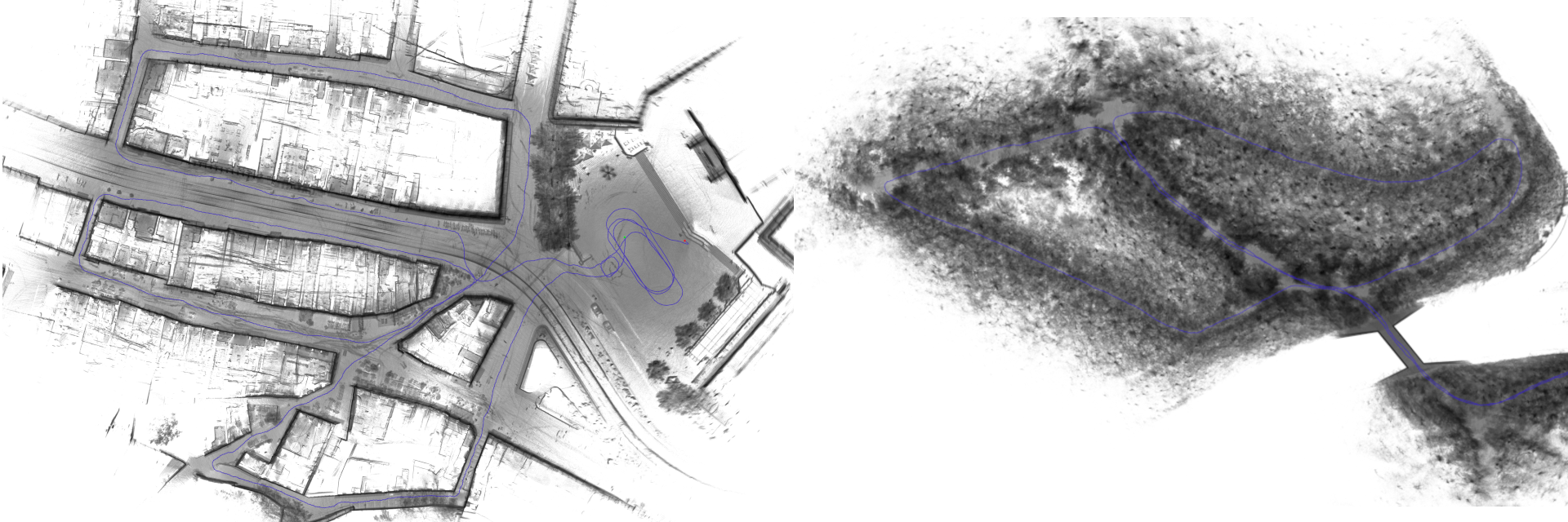
Here, we describe the two backpack MMS datasets that we publish. We captured both datasets in challenging environments. The first dataset is from a test site in the city centre and the second dataset is from another test site in a forest.
Both datasets contain a) image data with undistorted equidistant and anonymized images from the individual panoramic camera heads as well as the image timestamps, b) LiDAR data represented as timestamped point clouds in the sensor coordinate frame, c) navigation data with GNSS raw observations from the BIMAGE Backpack as well as from the reference station and IMU raw data.
City Centre
The first dataset was acquired in the city centre of Basel, Switzerland. The 800 m loop-shaped trajectory was recorded in 24 minutes. It includes different road and path widths including a large square with good GNSS reception for system initialization. By contrast, it also includes narrow alleys only accessible to pedestrians with steps and slopes up to 16 %. Wide pedestrian promenades with shops on both sides dominate other parts of the trajectory. In addition, there is a main traffic axis through the city centre with busy tram and bicycle traffic.
The dataset ‘city centre’ contains 721 panoramic images, approx. 840 million LiDAR points, GNSS data as available and IMU data. We provide 15 ground control points (GCPs) arranged in groups of three and 18 check points (CPs) along the first loop of the trajectory (see map below). Most of the GCPs and CPs are well defined natural reference points, but some were marked with photogrammetric targets. The reference points were determined by tachymetry and have a 3D standard deviation of 5 mm.
Organisations utilisatrices ou intéressées pour utiliser la ressource :
Contributeur(s) :
Tags : lidar, GNSS, image, Data, dataset
Catégories : Données, Connaissance
Thème : Open Street Map OSM, Données ouvertes, Urbanisme et ville
Référent :
Défi auquel répond la ressource : Augmenter les connaissances partagées en cartographie et usages des véhicules et réseaux de transports
Personnes clés à solliciter :
Autre commun proche : Dataset for autonomous driving, Lidar Dataset Volvo, Lyft Dataset from Lidar camera, Waymo open dataset
Richesse recherchée : Expérimentation, Moyen de prototypage - production - essais et calcul
Compétences recherchées :
Communauté d'intérêt : Communauté autour des données ouvertes, Communauté autour des traces de mobilité et des données associées, Communauté Cartographie Contributive
Type de licence :
Conditions Générales d’Utilisation (CGU) :
Niveau de développement :
Lien vers l’outil de gestion des actions :
Lien vers l’outil de partage de fichiers :
Besoins :
Prochaines étapes :
Documentation des expérimentations :
Autres informations
Liste des acteurs qui utilisent ou souhaitent utiliser ce commun : aucun pour le moment
Liste des CR d’atelier en lien avec ce commun :

 Français
 English
 Italiano