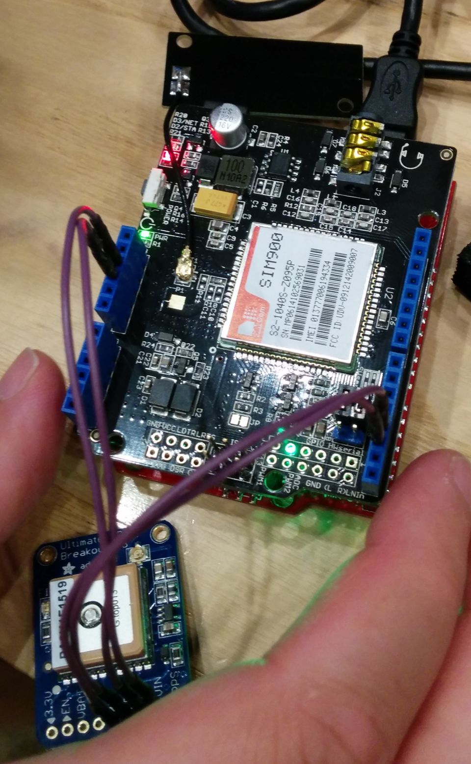
Bus Tracking GPS
Short Description: Open source tracker for bus
Description: Considering using this as an implementation for Miami Bus system in a hackathon, we were thinking of making an Arduino GPS with Cell GSM hardware board. We assumed that most Miami buses do not have location data since only a few buses show on the internet with live data. It seems that that about 10 % of Miami buses have real time location information online with API that is good for open source data . We were thinking of making an Arduino GPS Cell GSM phone module to load on the buses with the assumption that most Miami buses do not have GPS onboard.On second thoughts , it seems that perhaps the remaining majority (90% of ) buses already have GPS and internet onboard as Automatic Vehicle Location or "AVL" systems. See links for Miami like this RFP forAVL . Or the following : Miami XML data While the hardware may exist on the buses, there may be some software or City Budget issue that does not allow 90% of the Miami buses to have real time bus location data available to become open source or open data.The API for these 90% may not be proper or may be proprietary so these buses may not report location information to internet. The format for live data or Real Time bus location data may not exist for a open source and/or Google format. Montreal , NYC , and many other systems exist and may translate bus system AVL data to such appropriate open source formats.New buses may have location and internet connections with these AVL systems. Miami status TBD for most (90%? ) of bus routes . . So one theory would be to use existing hardware that is already on-board buses. There is no sense in duplicating complicated systems. Miami may be installing version 2.0 or eventually 3.0 but some workaround may be hacked to make location data available for open source just for the applicable real time location data of interest.Else - if no hardware/AVL is on-board Miami buses or for some older buses ( or the buses of interest/city for user) , then this Arduino system/software with GPS and GSM/Cell/internet connection is needed to be a source of bus location data. It is also noted that some integrated Arduino boards that incorporate GPS with GSM cell modems may exist as a integrated shields or even single board at a possible lower cost.As an option, Arduino boards that interface with Bus engine OnBoard Diagnostic Connector (OBD) systems may bring other data to this bus location system. A preferable interface for this may be bluetooth at the OBD BT going to the Arduino . The Arduio board may be elsewhere and anywhere on the bus with two wires for power and wireless decent reception, the OBD may give (too) many diagnostic streams , one stream of interest may be simple speed data for times when GPS data/reception is invalid. Tunnels.. gaps ,, dropouts. The OBD real time speed data from the wheels can be used to smooth the GPS data which comes in packets with errors etc from the satellite data. A simple model can be made using physics . The bus speed can only vary by a certain amount and not drop out instantly to zero as the GPS data may suggest or assume when satellite reception drops out.
Web Site : https://github.com/herrdragon/busTrackingGps/wiki/Installation
Organisations interested to contribute or already contributing:
Organisations using or interested to use the resource:
Contributor:
Tags: tracker, bus
Category: Matériel
Theme: Open HardWare
Referent:
Challenge addressed:
Key persons:
Other common:
Communauty of interest:
Type of common:
Produced in the field of OpenChallenge?
Level of developpment
Chat Space to discuss: [1]
Mailing list:
Task management link:
File management link:
Needs:
Complement:
Next step:
Others informations:

 Français
 English
 Italiano